Things To Do
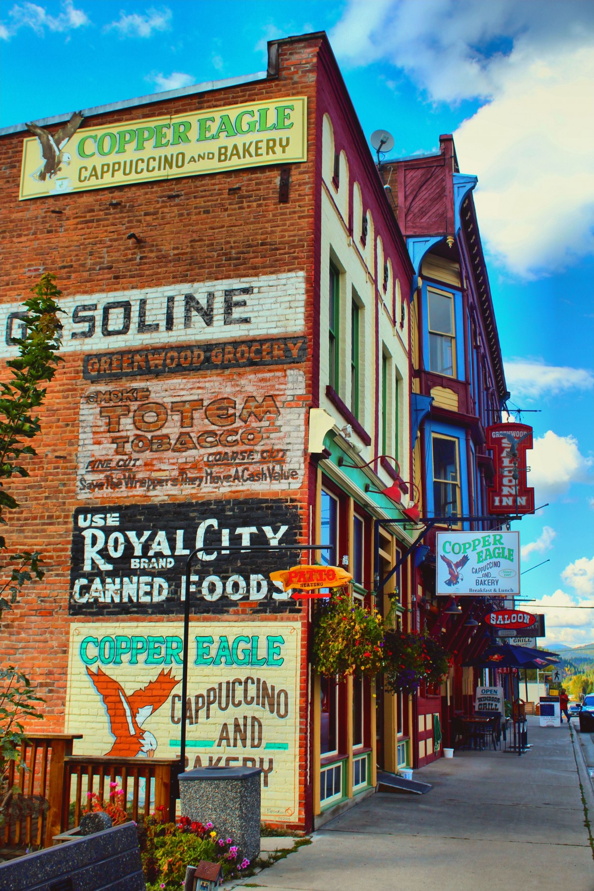
Many Canadians hold a romantic ideal of what life in a small-town might be like … shorter commutes, fresher air, safer streets, a stronger sense of community. Greenwood is Canada’s smallest city, a historic town, a community with 676 residents, located along Highway #3 nestled in the Kootenay Boundary region of southern British Columbia, and something to be seen. It is also ONLY 14 kms to the US border @ Midway.
Assay Building:
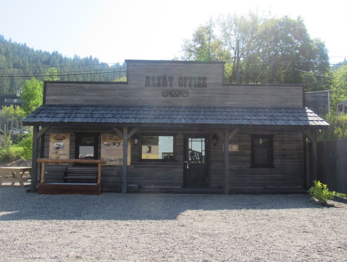 A replica of the assay office is located to the south of the Greenwood Museum. Peek through the windows and take a step back in time! The adjacent park is a perfect place for visitors to have a picnic lunch and a turn of the water trough tap provides a sample of “Greenwood Gold”: a 2012 winner of the Berkley Springs International Water Tasting for Best Municipal Water in the World.
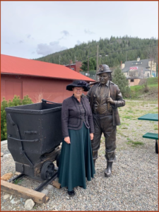
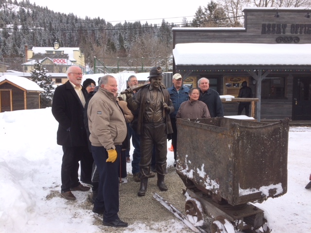 Greenwood, once known as the “Hub of the Boundary”, celebrated its mining history with a statue of a Bronze Miner in front of the Assay Office (next to the Museum).
The statue was unveiled on Feb. 21, 2018.
BC Copper Company Smelter Ruins:
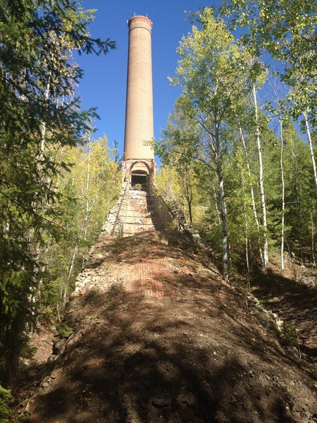 The BC Copper Company Smelter was erected in 1901 and operated until 1918 when the price of copper plummeted after the first World War. Abandoned since that time, it’s huge slag pile and tall brick chimney has become a landmark along Highway 3, with the site possessing a very appealing mystique.
The first furnace was blown in February 1901, and by 1906 the smelter was one of the finest and most modern in the Dominion of Canada. The plant had three mammoth furnaces boasting a daily capacity of 600 to 700 tons each. The City is currently writing grants and looking for funds to develop the BC Copper Company Ruins into a tourist destination.
 Visit Project Page
Boundary Falls:
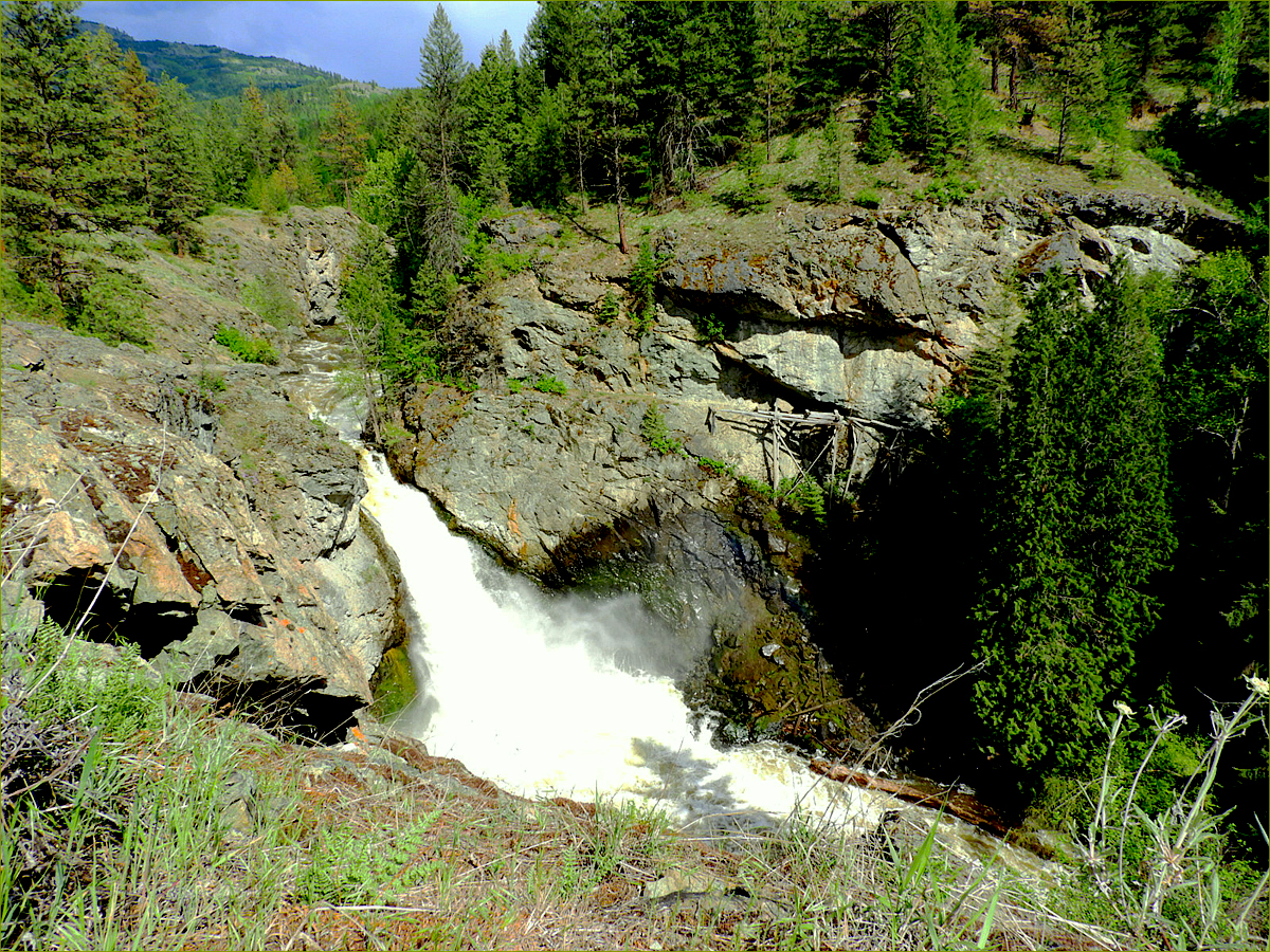
7 km south of Greenwood offers a scenic walk back in time to our colourful history as a power generation site, ore transportation terminal and smuggling depot for gold in the 1850s. In 1861 an adjustment to the international boundary put an end to these activities as Boundary Falls found itself on the Canadian side of the border.
As mining activities increased around Greenwood, Boundary Falls began providing hydro power to the community – and the remains of the wooden dam, first constructed in 1906, can still be seen today.
Two tramways crossed the creek near the falls while above the falls, The Lone Star Mining Company delivered ore to the Boundary Falls Smelter. The tramway, operated by the Number 7 Mining Company brought ore across the creek below the falls to a terminal near the present highway.
The Dewdney Trail, which was constructed in 1859, connected the southeastern gold fields with the coast, and crosses the creek just north of the falls.
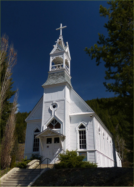
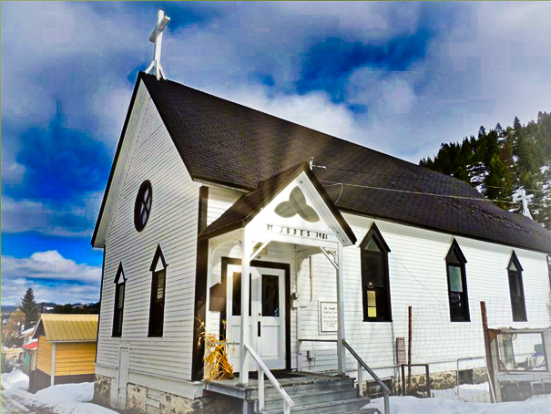
Churches:
 c.1899, Sacred Heart Roman Catholic Church
326 Church Avenue
Father Gabriel Chinnaperiannan
Mass: Saturday at 5 p.m
 c. 1899, St. Jude’s Anglican Church
The Reverend Austin Spry
145 S. Kimberley
(250) 442-5808
Services at 4:00 p.m. (1st, 3rd & 5th Sunday)
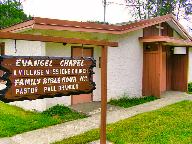 Greenwood Evangel Chapel
401 N. Kimberley
(250) 449-1978
Martin Fromme, Interim Pastor
Service – Sunday at 10 a.m.
Food Bank: Karen L. – (250) 584-4164
Photos: Beautiful Greenwood
Courthouse:
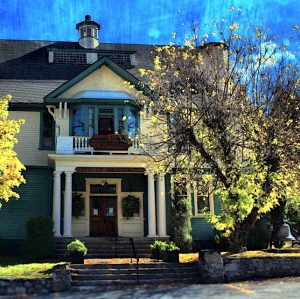
Tour this historic landmark with its resplendent courtroom, unique stained glass windows and attractive design. This magnificent building was designed by G.C. Curtis and constructed in 1903, then considered the finest structure in the area. Although the City of Greenwood administration occupies the main floor, the upper floor still accommodates the superb courtroom, ancillary rooms and chambers.
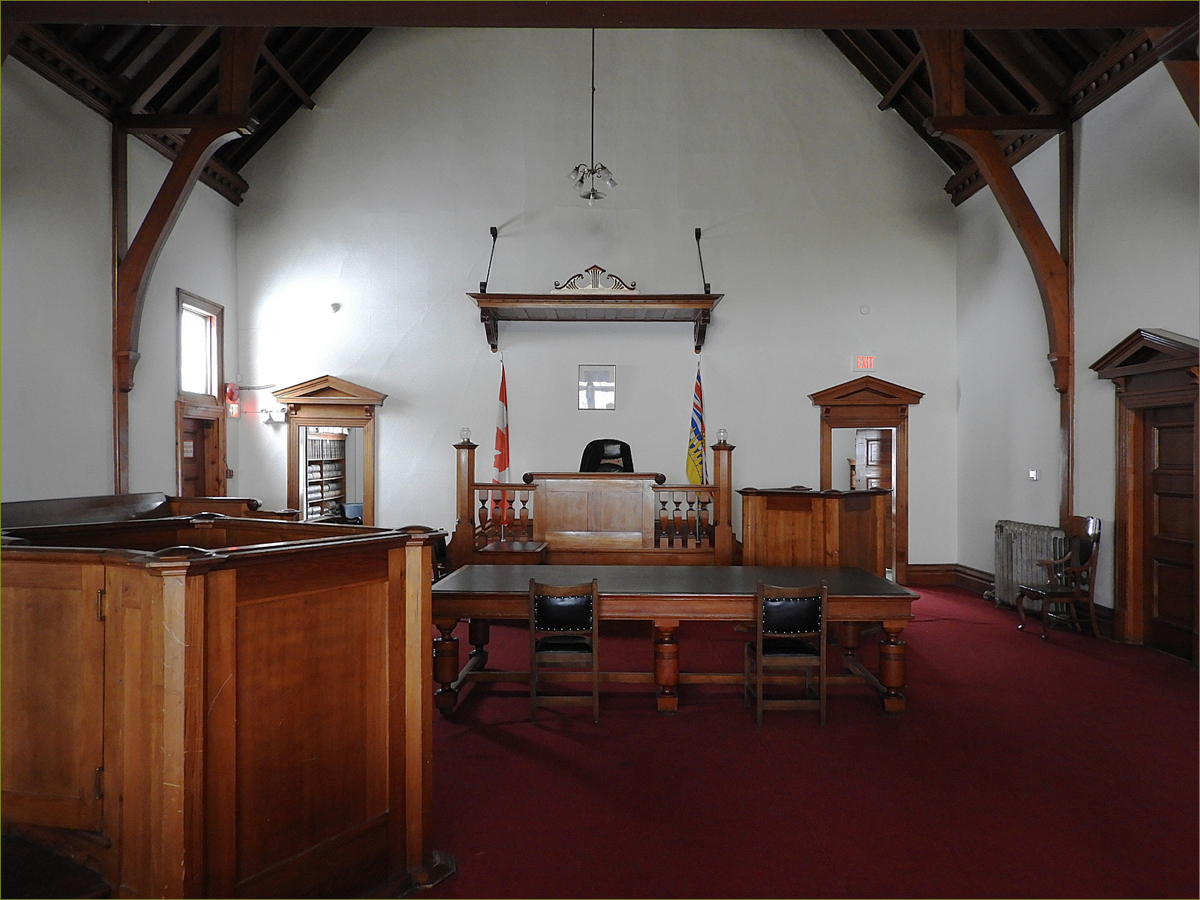
The courtroom is 32’ x 49’ and 24 feet high with the interior woodwork made of clear-grained coast cedar finished with oil. The Supreme Court features stained-glass skylights symbolizing the three saints of England, Scotland and Ireland comprising the flag of the Union Jack.
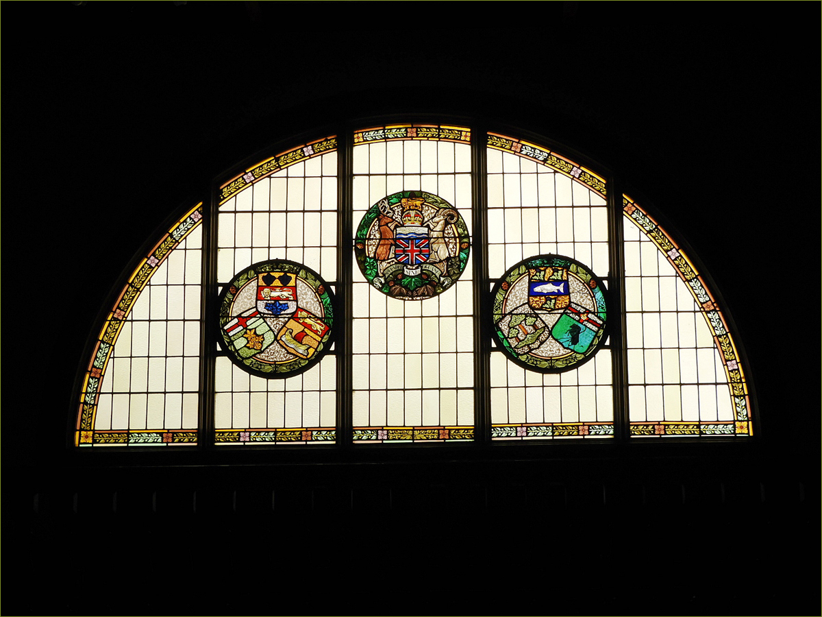
Additionally, the stained-glass windows above the gallery depict the seven provinces within the Confederation of Canada that existed in 1902. Adjacent to the prisoner’s box is a staircase that leads to the cellblock in the basement of the building. The basement has one original cell. Two metal cage cells were inserted after detained miners acquainted with hard-rock mining techniques escaped by breaking through the granite masonry foundation wall.
Fort Greenwood Private RV Park – The Old West’s finest gated community
Fort Greenwood is a private RV Gated Community situated along Boundary Creek in historical Greenwood BC. Lots are available for purchase. https://www.fortgreenwood.ca
Visit Fort Greenwood Image Gallery
Founder’s Day:
– July 13 & 14, 2024
Join us for Greenwood’s 127th Birthday Celebration
Facebook: https://www.facebook.com/foundersday
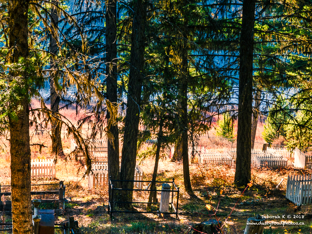
Greenwood Cemetery:
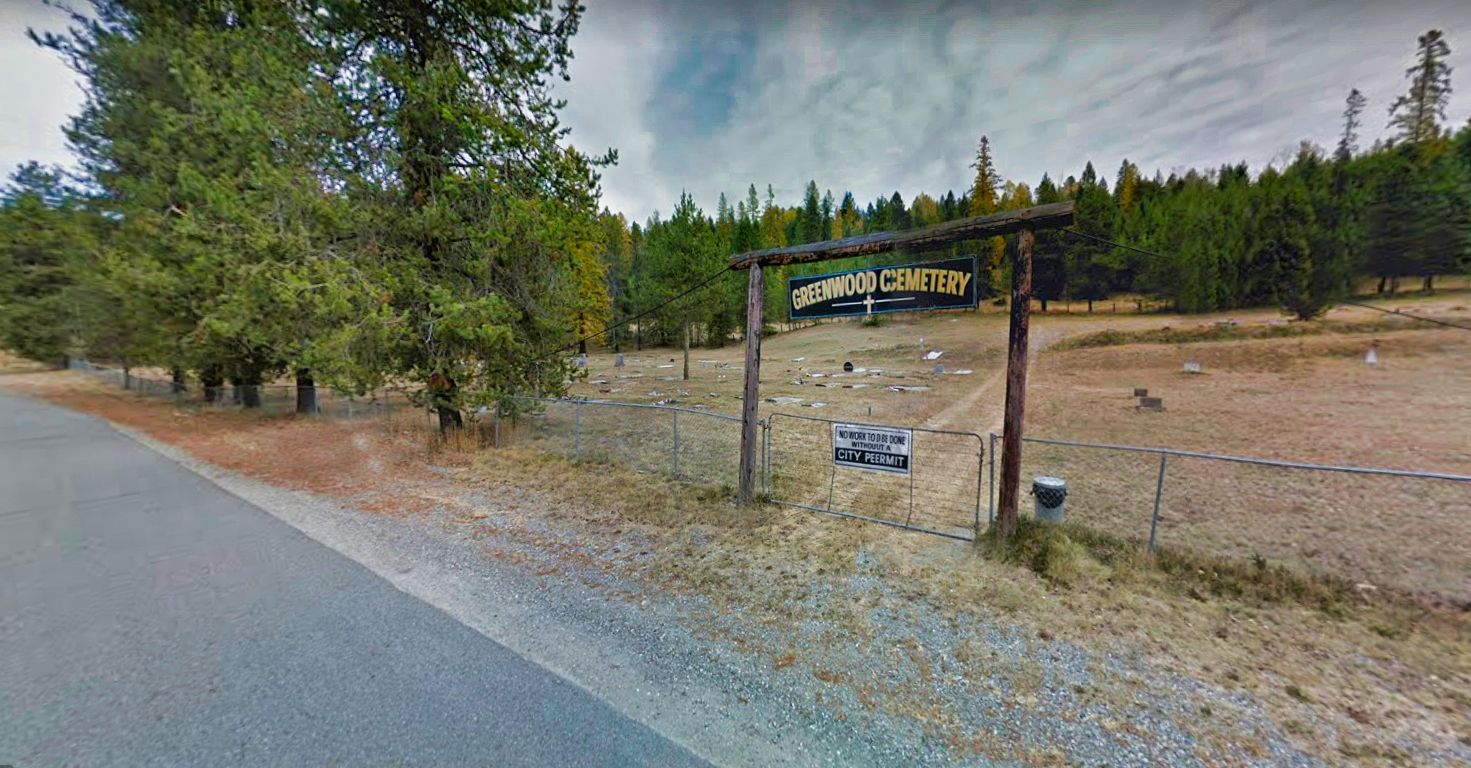
c. 1898
Travel on Hwy #3 East turn north onto Boundary Creek Road for 2 kms. At the Y, take the left road.
Residents of the Boundary area are interred in this cemetery, with the most famous grave being that of John Marion Jarrett, a member of William Quantrill’s gang. At the turn of the 20th century, Greenwood had three hospitals which contributed to the popularity of the local cemetery.
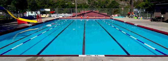
Greenwood Municipal Pool:
Greenwood Museum & Visitor Centre:
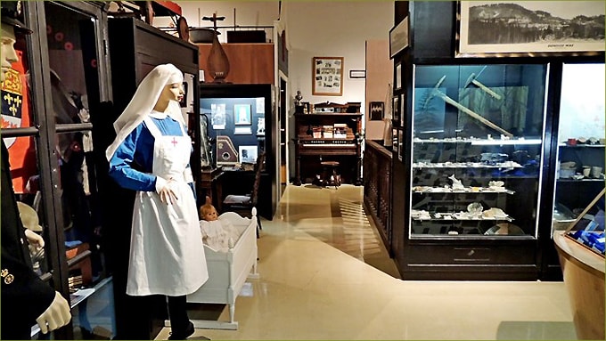 Tour this amazing Museum to see detailed exhibits depicting the mining era, military and logging history in the area, a recreated room from the Windsor Hotel, a general store, and a millinery store. See our one-of-a-kind exhibit showing John Jarrett – an early prospector, Civil War Veteran and a member of the Jesse James/ Cole Younger Gang – in a hotel bar display.
The Japanese Canadian Internment display depicts their forced internment during WWII. Family history buffs and historians enjoy the extensive photo gallery, archival and family history documents. Personal tours are provided upon request. Phone: 250-445-6355
Email: [email protected]
Visit Website
Greenwood Tours
 Greenwood Tours leads guided walks through the historic downtown area of Greenwood. Two different tours run most days throughout the season and arrangements can be made for private groups of 2 or more as well.
Check our website at https://www.greenwoodtours.ca/ for tour dates and times or call Maureen Grant at 778-677-3211 for more information.
Available Tours:
“Looking Back in Time”
Journey back in time to 1897 as our guide leads you through the City’s historic downtown and shares fascinating stories of this centuries old community. From the gold rush days to the copper mining boom we’ll see beautifully preserved heritage buildings and learn about the early settlers who built a thriving community in the rugged wilderness.
“Old Ghosts and Lost Souls”
Greenwood has had its share of paranormal activity, murder and mayhem. From mining accidents, suspicious fires to unsolved murders the city has over a century of stories to share as we explore some of it’s most haunting locations.
History Of Deadwood & Motherlode:
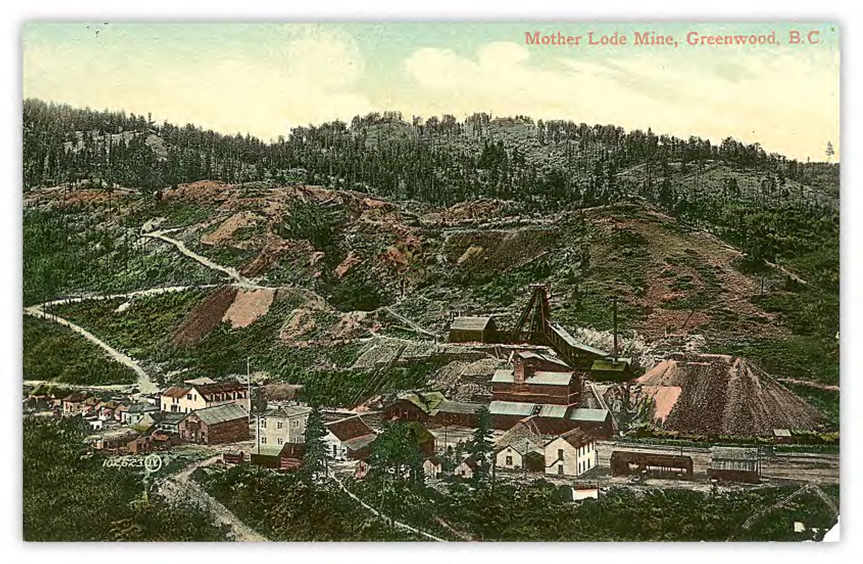
Drive over the Washington Street bridge off Highway 3 and follow the road 4 km past the BC Copper Company Smelter Site to Deadwood. Deadwood is a ghost town that existed in 1897. Traces of the Algoma Hotel may still exist, although the town of Deadwood is long gone . Boasting a 100 acre town site with two hotels, Deadwood also had a blacksmith, shoemaker shop, post office, school and many dwellings.
The surrounding area was staked with vast mineral claims; the most notable being the Motherlode Mine and Sunset Camp. The copper claims also included Big Ledge, Eagle, Butte City and Spoiled Horse … A spur of the Columbia and Western Railway from Greenwood ran through Deadwood enroute to the Motherlode Mine.
Deadwood also functioned as a loading point for ore from the BC Copper Company camp. The waste dump near the site offers visitors a chance to see iron pyrites, calcite crystals, chalcopyrite, tiny garnets and beautiful green epidote glittering in the sun.
Visit Deadwood & Motherlode Gallery
History of Japanese:
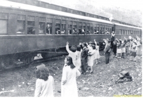
Greenwood, British Columbia, became the first internment center when Nikkei people were uprooted and “relocated” from the coast of B.C. On December 7, 1941
There were many vacant hotels available when Greenwood was once a booming smelter processing city of 3,000. Nearly 1,200 Nikkei filled the rooms of the old hotels and houses.
When war ended in 1945, other communities agreed with the government’s sanction on the Japanese people, Greenwood did not. How different the Nikkei history could have turned out if it wasn’t for Mayor McArthur’s decision to accept the Japanese Canadians to Greenwood? Visit the Greenwood Museum Nikkei history.
Greenwood’s Nikkei Legacy Park displays 80 family plaques of Nikkei and Caucasian families titled “We Lived Together.”
The family plaques will encourage former residents to return to their ‘furusato’ and pass on the legacy of their families to their grandchildren and great- grandchildren.
Discover Nikkei & Greenwood Article
Nikkei Legacy Park Gallery
Nikkei Legacy Park on Discover Nikkei
History of Mining:
 The Boundary Region was one of the biggest copper producing regions of the world. Greenwood, Phoenix, Deadwood, Boundary Falls, Eholt, Summit City, and Grand Forks all grew to house and service the men who worked in the copper mines, smelters and railways.
Greenwood’s population rose to around 3000. Take a self-guided walking tour of more than 60 heritage buildings and experience the reminders of yesterday.
History of Phoenix:
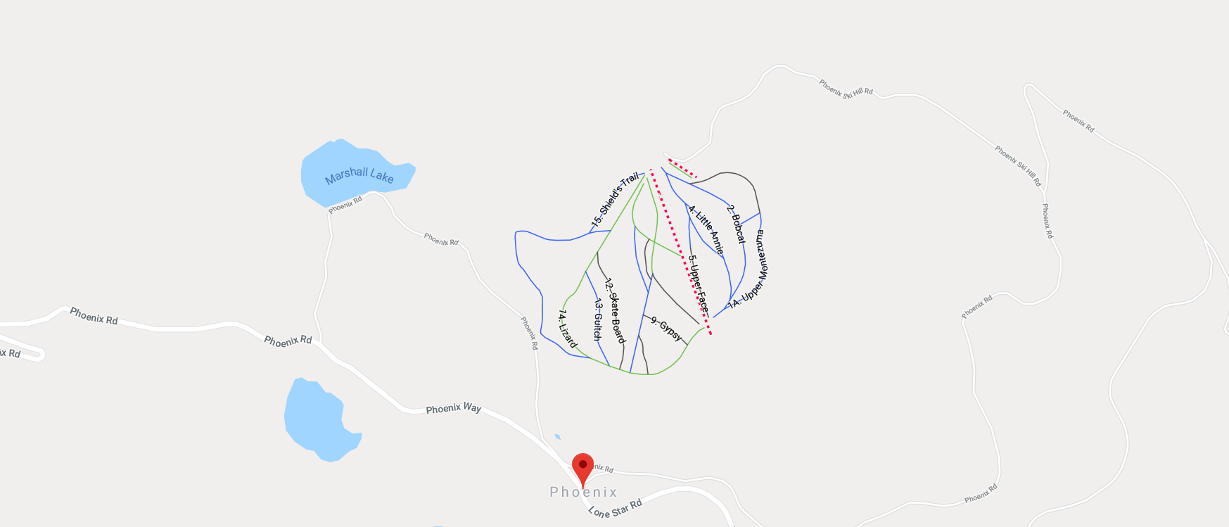 Phoenix, originally called Greenwood Camp, is located 8 km east of Greenwood. Formerly known as Canada’s highest city, the once-vibrant and prosperous City had a population of 3,000 people. The Granby Mining & Smelting Company operated a large underground mining operation beneath the city which started producing ore in 1901, and when it closed in 1919 had produced in excess of 13,000,000 tons. The City of Phoenix grew with the mining operation until the mines closed in 1919 turning Phoenix into a ghost town. In 1956 the Granby Company returned, sending concentrates from the open pit mine they built to Japan for smelting; Phoenix is now a large worked-out open pit.
Visit Phoenix Image Gallery
Jewel Lake:
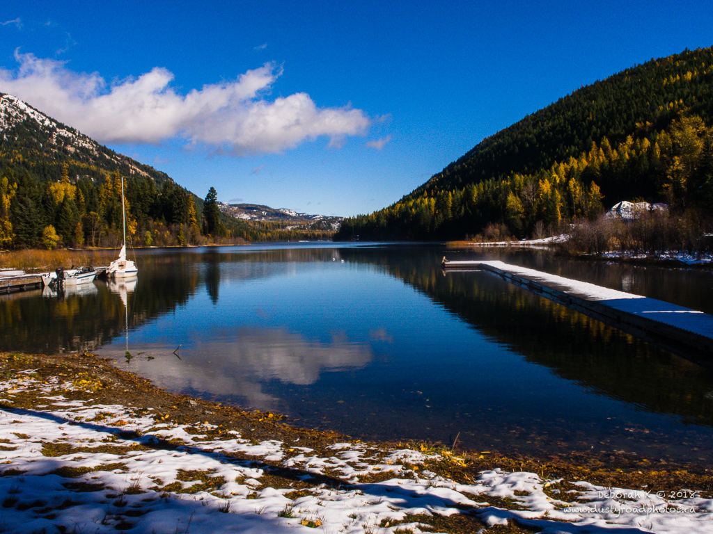 Drive north of Greenwood along the highway to the marked turnoff and follow the road for 10 km to the lake. Prospector Louis Bosshart established Jewel Lake Camp, starting the claim in 1895, mining for gold, silver and silica. Formerly called Long Lake, Jewel Lake nestles in a narrow valley surrounded by mountains and green timber.
Jewel Lake Resort occupies the south shore offering camping and picnicking areas as well as boat and cabin rentals while the Provincial campground is located on the north shore. The prime attractions are canoeing, kayaking, fishing, hiking, swimming and boating. In addition, ATV enthusiasts can drive to the look-out at Mt. Roderck Dhu.
See Video on Jewel Lake
Visit Jewel Lake Image Gallery
Marshall Lake:
Outdoor Recreation:
Hiking, Cycling and ATV Trails/Roads
Greenwood has an abundance of old mining and logging roads, which are enjoyed by hikers, mountain bikers, all-terrain and 4-wheel drive vehicles. Jubilee mountain offers a panoramic view of the City and great photo opportunities.
There is no shortage of exciting hiking/cycling trails for all ages and fitness levels. Many travel near abandoned mines sites or beautiful mountain lakes and streams. The Trans Canada Trail is easily accessible from town. A leisurely hike up Jubilee Mountain provides a great view of Greenwood and the Valley. On the south edge of town are the beautiful Boundary Falls, remnants of the Dewdney Trail and the Boundary Falls smelter slag.
Fishing, boating, hiking and camping are favourites at Jewel Lake, just 9 km north of Greenwood. East of town take the scenic, educational Phoenix Interpretive Forest drive. Map – Phoenix Interpretive Forest Maps are also available at the Greenwood Museum.
- Cycling
- Hiking
- Hunting
- Trans-Canada Trail
- Golf – Rock Creek Golf Course
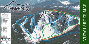
- Skiing – Phoenix ski hill, cross country
- Fishing at Jewel Lake (a 52.8 lb trout was pulled from the lake in the 1930’s)
- Marshall Lake
Parks:
- City Park
- Lions Park/Playground
- Nikkei Legacy Park
- Granby Park
- Boundary Falls
- Jewel Lake Provincial Park
- Lotzkar Memorial Park
- This unique industrial smelter ruin is one of the best preserved sites of its kind. The massive ridge of slag and the towering 36m brick smoke stack, stands as a memorial to past prosperity. Named after past owner Leon Lotzkar, the park features walking paths in and around building remnants and the unique “Hell’s Bell’s” (black slag cones). Explore at your own risk and please leave all artifacts on site.
Phoenix Cemetery:
 c. 1901
On the road to Phoenix, about 7 km from Greenwood is the old Phoenix Cemetery. The cemetery is the final resting place for many men killed in mining accidents and the devastating toll that an 1918 outbreak of influenza had on many families.
It is along a beautiful drive up to the old town site of Phoenix
Phoenix Ski Hill:
TransCanada Trail:
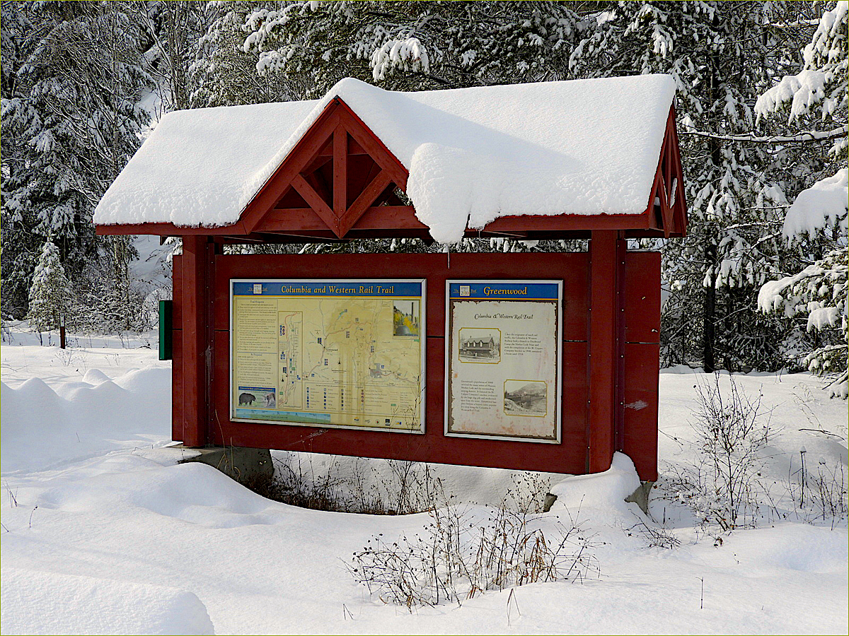
Greenwood is proud to be a gateway to the Trans Canada Trail, once the original Columbia & Western railway.
The Columbia and Western no longer operates but the old rail bed has been transformed into part of the Trans-Canada Trail linking British Columbia’s Boundary Region with the Okanagan and Vancouver Coast Regions.
This multi-use trail also goes eastward from Greenwood to Grand Forks and Christina Lake joining up with the historic Dewdney Trail and further points in eastern British Columbia.